terms & conditions
Before ordering we kindly ask you to familiarize to our terms and conditions.
availability
Please notice that the book selection of our online store is not available at the bookstore. If you wish to view some items, please make an order or contact us in advance.
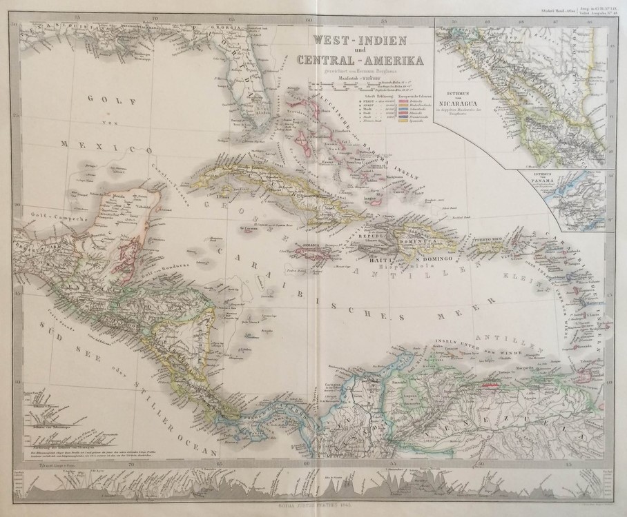
Thomson, John: West Indien und Central-America
€380,00
Description
Thomson, John (1777 -ca.1840)
“West Indien und Central-Amerika”
19th century map of the West Indies islands in the Caribbean area.
| Year of printing | 1817 |
|---|---|
| Technique | teräspiirros / stålstick / steel engraving |
| Illustrations | rajat värjätty käsin / gränskolorerad / outlines coloured |
| Dimensions | 53,5 x 64 cm |
| Condition | 3 |
| Condition explanations | (5) Mint, (4) Very good, (3) Good, (2) Fair, (1) Poor |
| Other | from Thomson’s New General Atlas |
(Karibia / Karibien / Caribbean)
Additional information
YEAR OF PUBLICATION:
1817
Illustrations:
rajat värjätty käsin / gränskolorerad / outlines coloured
Condition:
3
Condition explanations:
(5) Mint, (4) Very good, (3) Good, (2) Fair, (1) Poor
Dimensions:
53,5 x 64 cm
Technique:
teräspiirros / stålstick / steel engraving
Other:
Thomson's New General Atlas


