terms & conditions
Before ordering we kindly ask you to familiarize to our terms and conditions.
availability
Please notice that the book selection of our online store is not available at the bookstore. If you wish to view some items, please make an order or contact us in advance.
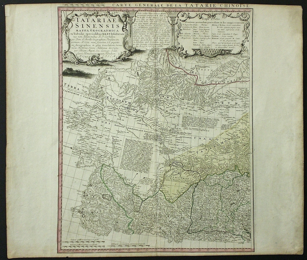
Mayer, T.; Homann heirs; D’Anville, J.B.B.: Tatariae Sinensis Mappa Geographica
€850,00
Description
Mayer, Tobias (1723-1762); Homann Heirs; D’Anville Jean Babtiste Burguignon (1697-1782)
Tatariae Sinensis Mappa Geographica ex Tabulis specialibus R.R.P.P. Iesuitarum nec non Relationibus R.P. Gerbillon per Dom. d’Anville Geographum Parisiensem primum..
18th century map of the Tartary area in Central Asia.
| Year of printing | 1749 |
|---|---|
| Place of printing | Nürnberg |
| Technique | kuparipiirros / kopparstick / copper engraving |
| Illustrations | käsin väritetty / handkolorerade / hand coloured |
| Dimensions | 50 x 40 cm |
| Condition | 3, upper margin a bit cut |
| Condition explanations | (5) Mint, (4) Very good, (3) Good, (2) Fair, (1) Poor |
One sheet from the two sheet map Carte Generale de la Tatarie Chinoise et des Rohaumes de Corée et De Iapan.
Additional information
YEAR OF PUBLICATION:
1749
Condition:
3
Condition explanations:
(5) Mint, (4) Very good, (3) Good, (2) Fair, (1) Poor
Dimensions:
50 x 40 cm
Other:
upper margin a bit cut


