terms & conditions
Before ordering we kindly ask you to familiarize to our terms and conditions.
availability
Please notice that the book selection of our online store is not available at the bookstore. If you wish to view some items, please make an order or contact us in advance.
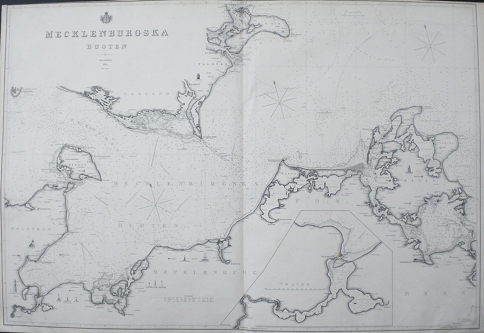
Klint, Gustaf af: Mecklenburgska Bugten
€320,00
Description
Gustaf af Klint (1771-1840)
Mecklenburgska Bugten (1863)
Swedish sea chart of the Bay of Mecklenburg between Germany and Denmark in the Baltic Sea.
Uncoloured engraving. Dimensions 68,5 × 100 cm. Good condition.
The map is made by Swedish cartographer and navy officer Gustaf af Klint. He produced “Sveriges sjöatlas” (the Swedish Sea atlas) with sea charts of the Swedish coast and seas close-by. Klint’s maps are very accurate and detailed.
| Year of printing | 1863 |
|---|---|
| Dimensions | 68,5 × 100 cm |
| Condition | 3 |
| Condition explanations | (5) Mint, (4) Very good, (3) Good, (2) Fair, (1) Poor |
Additional information
YEAR OF PUBLICATION:
1863
Condition:
3
Condition explanations:
(5) Mint, (4) Very good, (3) Good, (2) Fair, (1) Poor
Dimensions:
68,5x100


