terms & conditions
Before ordering we kindly ask you to familiarize to our terms and conditions.
availability
Please notice that the book selection of our online store is not available at the bookstore. If you wish to view some items, please make an order or contact us in advance.
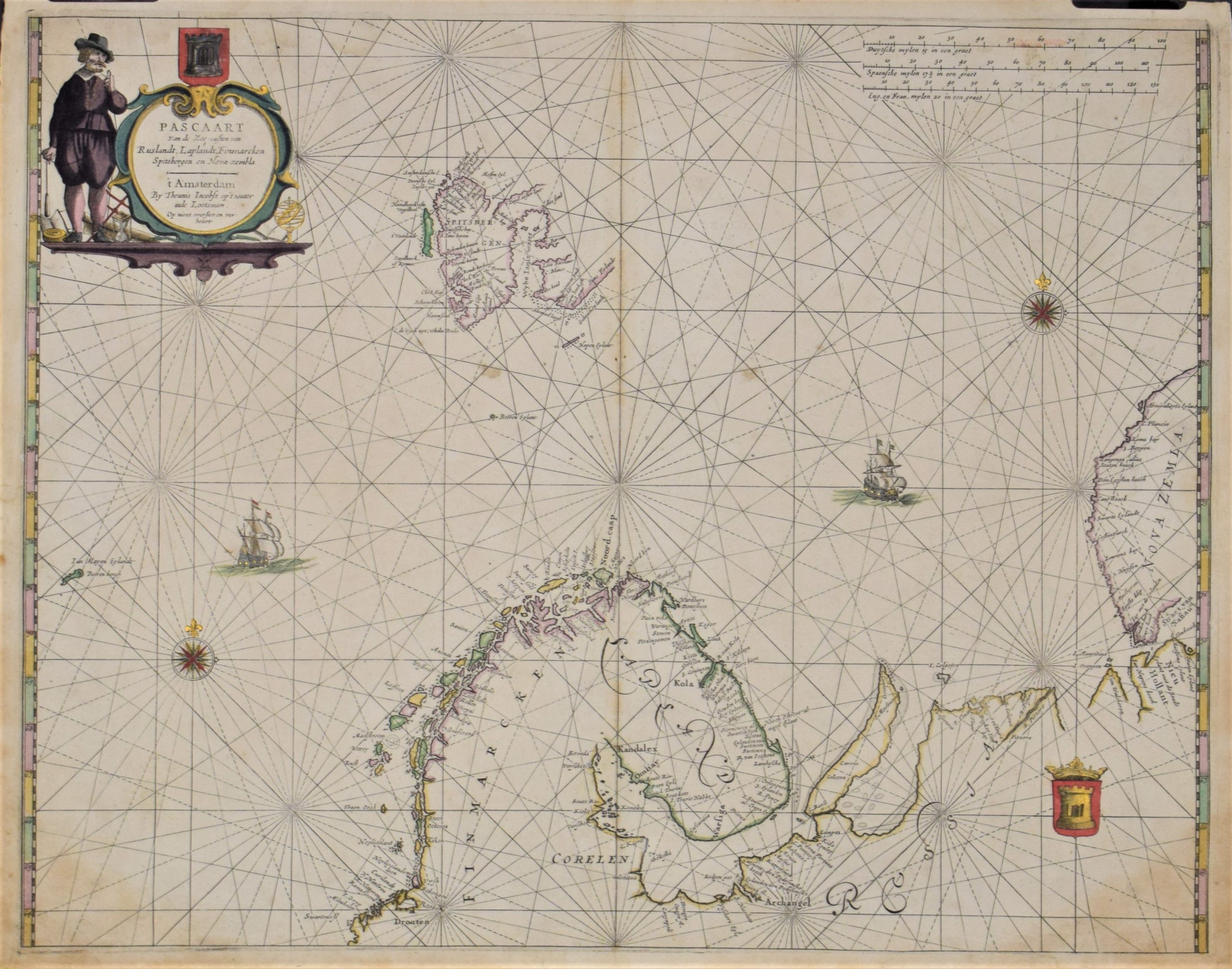
Jacobsz, Th.: Pascaart van de Zee-custen van Ruslandt, Laplandt, Finmarcken, Spitsbergen en Nova-zembla
€1.200,00
Description
Theunis Jacobsz (1606-1650)
Pascaart van de Zee-custen van Ruslandt, Laplandt, Finmarcken, Spitsbergen en Nova-zembla
17th century century sea chart of Lapland, Spitsbergen, Kola peninsula and Russia’s north coast until Nova Zemlya.
Copperplate engraving with outlines and decorations hand-coloured. Large cartouche, two compass roses and two coat-of-arms.
The map is strengthened from the verso side.
| Year of printing | ca. 1640 |
|---|---|
| Place of printing | Amsterdam |
| Technique | kuparipiirros / kopparstick / copper engraving |
| Illustrations | rajat väritetty / gränskolorerade / outlines hand coloured |
| Dimensions | 44,5 x 56 cm |
| Condition | 3. karttalehti vahvistettu / bakre sidan förstärkt / strengthened |
| Condition explanations | (5) Mint, (4) Very good, (3) Good, (2) Fair, (1) Poor |
Additional information


