terms & conditions
Before ordering we kindly ask you to familiarize to our terms and conditions.
availability
Please notice that the book selection of our online store is not available at the bookstore. If you wish to view some items, please make an order or contact us in advance.
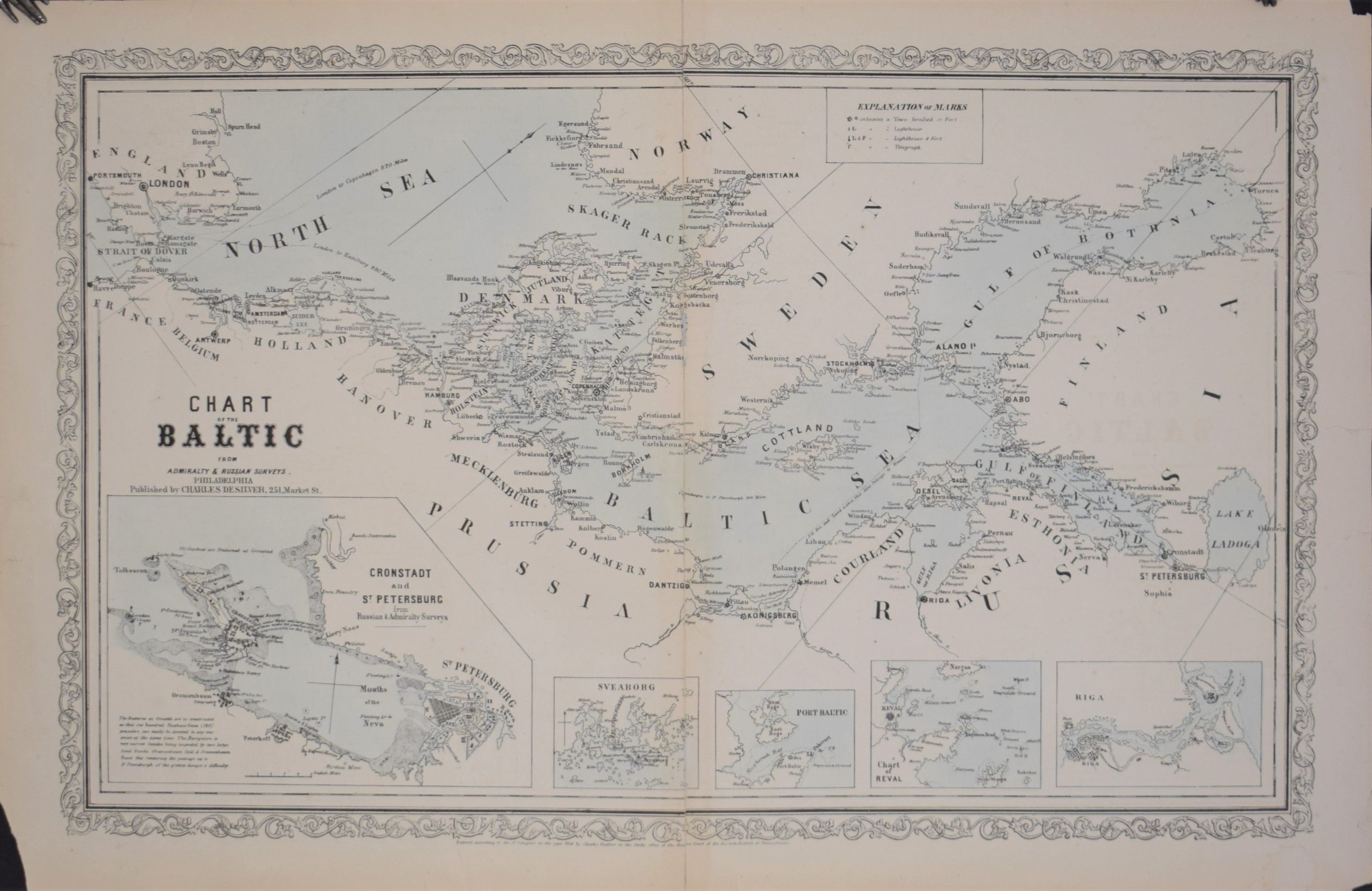
Desilver, Charles: Chart of the Baltic From Admiralty & Russian Surveys
€220,00
Description
Charles Desilver
Chart of the Baltic From Admiralty & Russian Surveys
Mid-19th century map of the Baltic Sea. Five small insert maps (Cronstadt &St.Petersburg, Sveaborg, Port Baltic, Chart of Reval and Riga).
Some tears in the margins.
| Year of printing | 1856 |
|---|---|
| Place of printing | Philadelphia |
| Technique | Kivipainokuva / litografi / lithographic print |
| Dimensions | 38,5 x 60,5 cm |
| Condition | 3 |
| Condition explanations | (5) Mint, (4) Very good, (3) Good, (2) Fair, (1) Poor |
| Other |
Additional information


